 The Queensway at Windemere
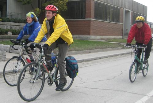
As first reported just over a week ago by Martin Koob at bikeToronto, new bike lanes have been installed on The Queensway between Windemere Ave. and Claude Ave. (map).
I often don't like bike lanes, especially when they are poorly designed or implemented, or when their state of disrepair makes me want to avoid them altogether. However, I think this is a welcome addition to this busy arterial road, and through this part of the city. Over the past week I had a few opportunities to ride this section of new bike lane at various times of day. Read on for more of my thoughts and photos.
The Queensway is a busy arterial road that connects the Queen-King-Roncessvalles intersection right out to Mississauga across southern Etobicoke. There's a streetcar right-of-way down the middle of it from Roncessvalles to around the Humber River. It's really not much to look at or write home about, as it's mainly a utilitarian road serving the motoring public.
From a cycling perspective, this section of road connects a few key locations nearby:
- High Park
- Parkdale / Queen West
- The lake shore and Martin Goodman Trail
- The #19 North bike route that goes up Ellis Ave to connect to the Runnymede Rd. bike lanes
- The off-road recreational trail along the south side of High Park and Grenadier Pond.
- It comes a bit short of connecting to the Humber River trail system to the west.
 The Queensway at Ellis Ave
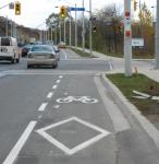
What do I like about this bike lane? First of all, it's wide enough to comfortably ride in without feeling like I'm in a gutter and motorists aren't buzzing right past my shoulder. Also, there's no parking/stopping allowed anywhere along here, so getting doored it not an issue. It seems like the motorists stay a bit further to the left now that the bike lane markings are installed. Perhaps the narrower lanes slow down traffic too, but that's purely speculation (is 60km/h still a reasonable limit for this road?). There are very few intersections or driveways along this road, so turning conflicts are minimized. The bike lane markings become dashed at intersections, as they should be, to allow motorists to properly merge before making their turns.
 Dangerous grates at east end
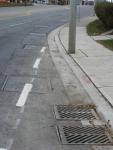
Dislikes? There are few. This is actually a pretty well designed and implemented bike lane. My only major concern is that when riding east, the bike lane ends somewhat suddenly. While riding quickly downhill, cyclists have to be prepared to merge back into the rest of the traffic, while also navigating around a bend in the road and at least six bumpy and slippery steel manhole covers. Extending this bike lane further east to make this corner safer would require moving a sidewalk and lamp post, or removing another lane of traffic. I doubt either will happen soon. However, I think it would help if the bumpy manhole covers were smoothed out somehow, and maybe even treated with some kind of grippy substance so they wouldn't be slippery. The transition area out of the bike lane should be longer, and perhaps a sign posted a bit sooner, so that cyclists are alerted to the lane change earlier. I always hated riding around this bend, even before the bike lanes went in.
It would also be nice if the bike lanes could be extended west to at least cross the nasty Humber River bridge to connect to the trails, and further west to the upcoming Stephen Ave. lanes. Perhaps if the Queensway-Kingsway interchange gets re-designed, this could become a reality.
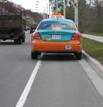 Beck Taxi in the bike lane
Anyway, there you have it. Another 1.8km of bike lane in the city. Plenty more to go before we catch up to the Bike Plan, but I won't complain about the good lanes that actually get installed. Now I hope we can just keep this bike lane from turning into another taxi parking spot!

